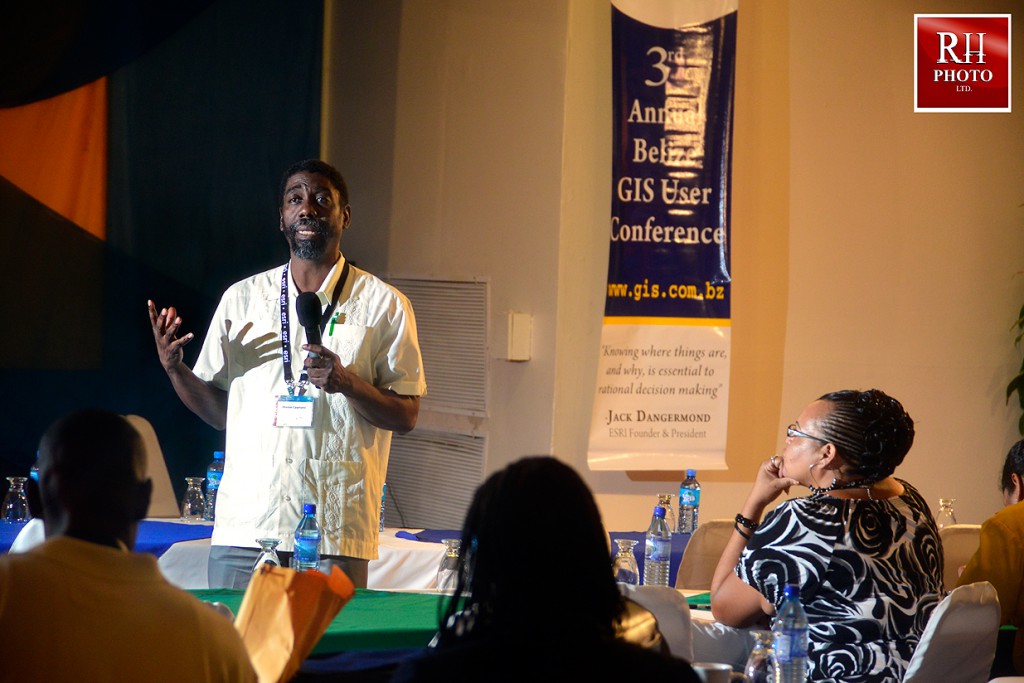
3rd Annual Belize GIS User Conference

Marion Cayetano at Wrap Up Session of Day 1
Total Business Solutions Limited [TBSL], the local Esri distributor, and Esri, the leading Geographic Information System (GIS) software company, teamed up again to host the 3rd Annual Belize GIS Users Conference (BGUC) at the Best Western Belize Biltmore Plaza on Wednesday and Thursday, January 23-24, 2013. The conference provided a forum for over 100 participants to share their work and expand their GIS knowledge and become a part of a global community that is using this cutting edge technology as a foundation for business and national development.
The Official ceremony started with a welcome by Mrs. Loretta Palacio, Managing Director, TBSL. Mrs. Palacio welcomed the audience and expressed gratitude for their unwavering support in working with TBSL to nationalize GIS in Belize. “We will do this together,” says Mrs. Palacio.
Ms. Cecille Blake, Member, United Nations GIS Secretariat Team, New York, delivered a gripping Keynote Address via video conference with technical support provided by Belize Telemedia Ltd. She shared how GIS is supporting national development in various countries in particular, Jamaica, her home. Ms. Blake made recommendations based on best practices for GIS in national development.
The goal of the conference was to show how Location Intelligence and Analytics can help organizations to unlock the power of their information to support business growth. The conference theme “GIS: Unlocking the Power and the WHERE of your Data,” was highlighted through the various presentations delivered by Esri, Esri Partners and local GIS users. The agenda revolved around how successful GIS solutions are being implemented in various business sectors and how it impacts our Belizean economy. Presenters included Land Information Center, Coastal Zone Management Authority, Statistical Institute of Belize, Belize Electricity Ltd., Healthy Reefs, Belize Meteorology Department, Penn State University, GeoEye, Tyler Technologies, Stewart Global, Esri and TBSL. Some of these organizations also mounted an exhibition of their work demonstrating how they are using Esri technology to manage their data and make informed decisions.
The Plenary and Industry Specific talks covered a wide range of industries including Remote Sensing, Agriculture, Conservation, Retail & Distribution, Education, Utilities, Local Government, Banking and Insurance. Also included were valuable technical workshops that helped participants learn and explore the latest Esri technology important to their business needs.
Other conference highlights included the GIS Solutions Expo, Hands-on Learning Lab, and Map Gallery, giving participants the opportunity to get hands-on demonstration and training, showcase their work, network, and continue building our Belize GIS community. TBSL also awarded local organizations who have been supportive in its effort to promote GIS technology to the nation. These are UNDP, Belize Telemedia Ltd, Belize Premier Charters & Tours, Santiago Castillo Ltd, Citrus Growers Association, Coastal Zone Management, Statistical Institute of Belize, Land Information Center, Belize Natural Energy and Belize Electricity Ltd.
The winners of the Map Competition are: Most Unique, Frank Tench; Best Cartographic, Land Information Center and Best Analytical Presentation, Statistical Institute of Belize.
The conference was a great success. Participants expressed an eagerness to work together as a community of professionals who will network to learn, share knowledge and develop Belize through geo spatial technology.


 TBSL is an established Belizean IT solutions company that provides high quality and cost-effective business solutions to the corporate market with a management team of 20 years of GIS and business solutions experience combined.