

Create and Share Beautiful Maps
ArcGIS is a system that lets you easily author data, maps, globes, and models on the desktop and serve them out for use on a desktop, in a browser, or in the field via mobile devices, depending on the needs of your organization. If you are a developer, ArcGIS gives you tools for building your own applications.
Overview
People are using ArcGIS in all types of organizations to improve their workflows and solve their most challenging issues.
ArcGIS helps you with:
- Asset/data management including systems integration, claims/case management, service/territory area management, and constituent/customer management
- Planning and analysis such as forecasting and risk analysis
- Business operations such as call center/dispatching; monitoring and tracking; field data collection; inspections, maintenance and operations; and routing
- Situational awareness including decision support and customer/public access
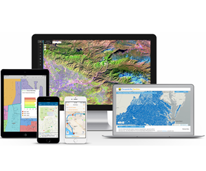
ArcGIS Works Across the Enterprise
ArcGIS is a system for people who rely on accurate geographic information to make decisions. It facilitates collaboration and lets you easily author data, maps, globes, and models on the desktop and serve them out for use on a desktop, in a browser, or in the field, depending on the needs of your organization.
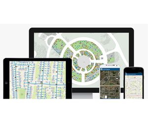
Apps for Everyone
ArcGIS apps make you more effective and efficient, no matter your goal. They’re designed to guide you through specific tasks and get work done with the greatest ease and maximum benefit. They’re spatially intelligent. They come ready to work for you, with little to no configuration required, with or without an Internet connection.
ArcGIS Solutions
Save time with maps, apps, and platform configurations specific to your industry. Use templates to configure ArcGIS applications, deploy web apps, and implement best practices. ArcGIS Solutions are available for a range of industries such as local and state government, emergency management, utilities, telecommunications, military, and intelligence.
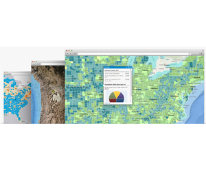
Ready to Use Maps
ArcGIS includes a Living Atlas of the World, comprised of authoritative maps and data on thousands of topics. Go beyond basemaps and imagery and explore maps about people and businesses, landscapes and the climate, transportation, and much more.
ArcGIS Products
ArcGIS Online
ArcGIS for Desktop
ArcGIS for Server

 TBSL is an established Belizean IT solutions company that provides high quality and cost-effective business solutions to the corporate market with a management team of 20 years of GIS and business solutions experience combined.