BEUC Home || Agenda || Registration || Speakers || Sponsors
BEUC Speakers & Presenters
 |
CECILLE BLAKE (Keynote Speaker);Team Member, United Nations Global Geospatial Information Management Secretariat Ms. Blake is a thought leader in the use of GIS. She has extensive experience at the hands on level as well as at the strategic and policy level. She helped to develop country level geographic information systems and national spatial data infrastructure in Jamaica, and she is now applying that experience throughout the Americas through the Global Geospatial Information Management (GGIM) Secretariat of the UN which she joined in August 2012
|
 |
MARCELLO BLAKE; General Manager, GraceKennedy (Belize) Ltd. Marcello Blake joined the GK Foods team (a division of GraceKennedy Ltd.) as an Accounts Receivable Clerk / Systems Administrator in 2001 for GraceKennedy (Belize) Ltd. (GKB) He worked his way to the post of Accountant/ Systems Administrator by 2003, Finance Manager with responsibility for Network Administration in 2006 and now holds the post of General Manager since February 2014. He is charged with further developing and expanding profitable sales of Grace branded products within the market. Marcello’s knowledge of the business and leadership skills equip him with the ability to lead GKB’s management team as the company continues to grow its Brands and expand into Central America.
|
 |
JUAN MIGUEL INDEKEU; Project Manager, Geosistec Juan Miguel Indekeu is a project manager at Geosistec, the Esri Distributor in Guatemala. His main areas are System Design, Web Developing, desktop, mobile, enterprise GIS in public, private and non-governmental organizations. Juan has extensive experience in Geographic Information Systems, Remote Sensing, Management and support of GPS systems. He has consulted on GIS in the field of thematic mapping, natural resources, transportation, networks, distribution and logistics, geo-marketing, telecommunications, hydrology, precision agriculture, utilities, Internet mapping, AVL, mining and oil. In addition, he has extensive experience in GIS application development using web technologies for Flex, Silverlight, .NET, JavaScript and Web services consumption GIS-based REST and SOAP. Programming: .NET, Python, JavaScript, C #, WPF and VB.
|
 |
PAMELA KERSH; Solutions Engineer, Esri Pamela Kersh is a Solution Engineer, Esri with 20+ years GIS/Remote Sensing experience , Background includes experience in the following industries: cartographic publication design and production, international oil and gas exploration, environmental remediation and litigation, deforestation monitoring and surveillance systems, various environmental engineering projects, telecommunications, joined Esri in June 2005. Responsible for supporting regional and corporate sales and marketing efforts, developing and presenting software solution demonstrations, supporting our customers with GIS projects and proof of concepts
|
 |
HEATH HILL; Account Manager, Esri Heath is the Esri Account Manager for Central America and the Caribbean. Heath has over ten years of professional experience and has been with Esri for nearly four years. Prior to Esri, Heath spent seven years in the Financial Services industry in both investment and retail banking; most of which time was spent working at Goldman Sachs. While at Goldman Sachs one of Heath’s most significant roles was managing complex client relationships for multiple sales teams. Heath also spent a couple of years in a trucking and logistics company, on the financial side of the business. Heath has an MBA from the University of North Carolina in Chapel Hill and his bachelor’s degree in International Business Management. Heath is very passionate about this region of the world; he lived in Brazil for a couple of years and his wife of 11 years is born and raised in the Dominican Republic. He speaks both Spanish and Portuguese fluently and understands well many of the cultural dynamics within the Caribbean and Latin America.
|
 |
MARION CAYETANO; GIS Consultant Marion Cayetano is a highly respected leader in the field of GIS in Belize. With over 14 years of GIS experience, Mr. Cayetano has taught GIS in various sectors such as: education, agriculture, social development and information technology. Along with teaching experience he also has experience applying GIS to a broad range of projects. Mr. Cayetano holds a Bachelor’s Degree in Agronomy from the University of the West Indies, a Masters Degree in Rural Resource and Environmental Policy from the University of London and a Graduate Diploma in Management (Applied) from McGill University. He is co-founder of Galen University and has been integrally involved in the development of the university and its academic and research programs.
|
 |
ADELE RAMOS; Assistant editor, Amandala Adele is the Assistant Editor of the Amandala newspaper, has worked over a decade in the media. In August 2014, she began using ArcGIS Online.
|
 |
CPL. JOSE TILLETT; Belize Police Department Mr. Jose Tillett has been with the Belize Police Police Department for the last twelve years. He has had experience as a survey technician and a Land Adjudication officer from pre GPS days. He is a Corporal of Police and a GIS officer, at the Police Information Technology Unit (PITU), in the Belize Police Department. He has a passion for GIS and as a well trained Police Officer, is bringing new GIS technology for use by the Belize Police Department.
|
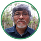 |
MR. HARRY NOBLE; Belize Police Department Mr. Harry Noble has been working as a consultant in various new technological fields, for the Belize Police Department for over thirteen years. His work has made the Police Information Technology Unit (PITU), one of the most efficient and self sustained IT unit in the country. He still continues to do great work for the Belize Police Department.
|
 |
JULIO MAAZ; GIS Technician, Wildlife Conservation Society Julio Maaz is the Community Fisheries Coordinator at the Wildlife Conservation Society, a post he has held for the past 6 years. He coordinates the implementation of the Spatial Monitoring and Reporting Tool (SMART), the deployment of Unmanned Aerial Vehicles (UAV’s), the introduction of a cellular based Vessel Monitoring System pilot project, and assists with the implementation of the Managed Access fisheries management program, along with many other initiatives.
|
 |
ROBERT HERNANDEZ; Student, University of Belize Robert is an aspiring GIS technician, is currently enrolled in the Bachelors of Natural Resource Management Program at the University of Belize.
|
 |
DR. PERCIVAL CHO; Post-Doctoral Research Associate, Belize Forestry Department Dr. Cho holds a Ph.D. in Environmental and Biological Sciences from the United Kingdom, and has over 10 years of experience using GIS and Remote Sensing.
|
 |
GERTRUDES VELASQUEZ; Faculty Member, University of Belize Mr. Gertrudes Velasquez is currently a faculty member in the Faculty of Science and Technology at the University of Belize. He has taught mathematics at the secondary and tertiary levels of education for the past 24 years. He has a Master’s degree in Measurement and Statistics from Florida State University. His area of expertise includes development of valid and reliable classroom and large-scale educational assessments.
|
 |
FRANK TENCH; Meteorologist St. John’s College Sixth Form(1974-1976)completed with Associate of Science degree(Natural Sciences); Caribbean Meteorological Institute(1983-1984)completed with certificate of training; University College of Belize)(1992-1998)completed with Bachelor of Science degree(Business Administration). Employed at National Meteorological Service of Belize (1976-2014).Retired from the National Meteorological Service in February,2015.
|
 |
ESTEVAN ASSI; Compliance Officer, Toledo Cacao Growers Association Estevan Assi is the current Compliance Officer for the Toledo Cacao Growers Association and is responsible for Organic and Fairtrade Certification, Quality and TCGA’s Internal Control System. His responsibilities include tracking production, implementing and enforcing strategies and procedures to enhance quality, conducting trainings, preparing for inspections, etc.
|
 |
VANEIRI KEME; GIS Technician, TBSL Vaneiri Keme holds a Bachelor’s Degree from the University of Belize on Natural Resources Management. After being introduced to GIS in the University of Belize, her interest grew daily! During the summer of 2012, she had the privilege to be an intern at the Land information Centre. After completion of her degree, the Sustainable Tourism Program also presented her with the opportunity to work on Ambergris Caye Building Footprint. She was also part of the Sugar Industry Management Information System in developing the sugar cane parcel layer. Ms. Keme is presently one of TBSL’s GIS Technician.
|
 |
ANDREW LINK; GIS Technician, TBSL Andrew graduated from the University of Belize with a Bachelor’s Degree in Natural Resource Management and Associates Degree in Information Technology. He has over 4 years of GIS experience in the ArcGIS Platform, Esri’s Technology.
|
 |
DR. VINCENT PALACIO; Dean of the faculty of Management and Social Sciences, University of Belize Dr. Vincent Palacio is the Dean of the Faculty of Management and Social Sciences of the University of Belize. A position he has held for the past five years. He leads a team of 24 full-time faculty members in offering relevant, accessible and cost effective education and training to Belizeans at the tertiary level. Dr. Palacio was the lead author of the National Tour Guide Training Program. He also supervised the development of severa tourism training programs when he was employed as the Director of Tourism Training at the Belize Tourism Board. He has conducted research on the Impact of Cruise Tourism on Belize. And has developed site management plans for several protected areas.
|
 |
SIMON THOMPSON; Director, Commercial Solutions, Esri Simon is the Director of Commercial Solutions at Esri. He has over 20 years experience location analytics working with everyone from startups to the fortune 100s. He specializes in business management, marketing, strategic consultancy, systems design, product planning and specification, enterprise systems, server architectures, and software implementation.
|
 |
BILL MEEHAN; Director, Utility Solutions, Esri Bill is the Director of Utilities Solutions at Esri. He is the author of Empowering Electric and Gas Utilities with GIS, Power System Analysis by Digital Computer, Modeling Electric Distribution with GIS, and GIS for Enhanced Electric Utility Performance. Bill has lectured extensively and taught courses at Northeastern University and the University of Massachusetts. He holds a B.S. in Electrical Engineering from Northeastern University and an M.S. in Electric Power Engineering from Rensselaer Polytechnic Institute.
|
 |
BRIAN BALDWIN; Electric and Gas Lead for Patterns and Practices, Esri Brian has been working in the GIS and geospatial industry for more than 13 years, having worked in a broad range of industries from crime analysis to conservation. Brian currently works for Esri in Redlands as the Electric and Gas Lead for Patterns and Practices. In his role, Brian works closely with partners and customers to communicate industry trends and developments in spatial technology. Brian has taught GIS at the University of Wisconsin-Milwaukee and enjoys writing and conducting research on the latest trends in real-time data and innovative applications of GIS.
|
 |
EMIL CHERRINGTON; Doctoral Researcher, AgroParisTech, France Emil Cherrington has been involved with GIS in Belize for over a decade, through work with the Government of Belize, and at the international level. From early 2006 through late 2013, Emil was Senior Scientist at the Water Center for the Humid Tropics of Latin America and the Caribbean (CATHALAC), an inter-governmental research entity based in Panama. Prior to his tenure at CATHALAC, Emil served as Data Analyst at Belize’s Coastal Zone Management Authority & Institute (CZMAI). Emil is currently a doctoral researcher at the French mixed research unit AMAP in Montpellier, and is affiliated to France’s Research Institute for Development (IRD). In that context, Emil is pursuing a PhD in forest ecology jointly student at both AgroParisTech in France and the Technological University of Dresden in Germany.
|
 |
RANDY FRANTZ; Global Marketing Director, Telecommunications & LBS Solutions, Esri Randy has 32 years of experience working in the telecommunications, internet and cable TV industry. He was vice president for Cox Communications’ new product operations in the Arizona market where he launched their telephone, digital television and DOCSIS cable modem services. Randy held numerous leadership positions at Verizon, including director of network design for International where he was responsible for business development in central Asia, Europe and Russia. Randy has an MBA from Widener University and is a distinguished graduate from the US Air Force Academy where he received a BSEE. He previously served on the board of directors for the Arizona Telecommunications and Information Council and the Dean’s Council for College of Extended Education at Arizona State University. He served in the public sector through the fellowship program at Brookings Institution and on the staff of the U.S. House of Representatives Foreign Affairs Asia Pacific Subcommittee.
|
 |
PATRICK HULS; Technical Specialist, Telecommunications & Cable Sector, Esri As a technical evangelist for the Telecommunications industry, Patrick Huls is responsible for understanding the technology needs of the telecom market, rapid prototyping and solution development utilizing GIS technology, and GIS outreach within Telecommunications. Prior to his work at Esri, Patrick was a GIS Analyst with a consulting firm that worked closely with large utility, construction, and engineering firms on utility and telecom construction projects. There, Patrick designed and built an enterprise wide GIS system which incorporated server, desktop, web, and mobile components.
|
 |
NIRAV SHAH; President, EI Technologies, LLC. Nirav Shah is President of EI Technologies, LLC. He has been helping government agencies implement GIS solutions for the past 25 years. Under his leadership, EI Technologies has completed all of our projects on time and within budget, a claim no other vendor in this industry can make.
|

 TBSL is an established Belizean IT solutions company that provides high quality and cost-effective business solutions to the corporate market with a management team of 20 years of GIS and business solutions experience combined.